
History of the Appalachian Mountains
Although the Appalachian Mountains currently reside on a passive plate margin their geological history is both active and complex. The geological data observed today shows that the Appalachian Mountains were formed long ago through tectonic plate collisions. The first of these episodes took place 450 million years ago when an ocean plate subducted under the North American craton both activating the plate margin and creating the initial mountain chain. The early Appalachian Mountains reached their peak when the North American craton collided with Africa to form Pangaea.
When Pangaea broke apart 200 million years ago the mountain building activity came to a halt and the Appalachian Mountain region became a passive margin once again. Natural weathering and erosion took place and the once great Ancient Appalachian Mountains became almost a flat plain. However, sometime during the past 65 million years uplift resumed causing a resurgence of the mountains and creating the Appalachians we know today. This study looks to dive deeper into the mysterious uplift and resurgence of the mountains by observing mantle flow as well as the structure of the crust and mantle.
Seismology
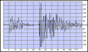
Seismology is the study of earthquakes. Earthquakes cause energy to be transmitted through the earth like sound waves through the air. These seismic waves are recorded by seismographs and can tell us not only about the nature of the earthquake being recorded but the structure of the earth that the waves travelled through. For example, since waves travel faster through a denser medium, in this case rock, the time it takes for the vibrations to reach the seismograph can reveal what type of rock lies in between the seismograph and the epicenter (origin) of the earthquake.
Courtesy of USGS
Geomorphology
Geomorphology is the study of the shape and structure of the earth’s crust and how it came to be that way. The forms of the landmasses we observe are our first clue as to the geologic history of the earth. A simple example of this is mountains. If one stretch of the earth’s surface is much higher than the surrounding area, then some powerful forces must have occurred in that region. One such geomorphological feature we will be exploiting in this study are raised portions of riverbeds called ‘nick points’ (which should otherwise be flat and continuous due to erosion) that give us information about recent topographic changes. Geomorphology is one useful puzzle piece that helps us put together the history of the tectonic, volcanic, glacial and other processes that have shaped our planet.

Courtesy of USGS
Isostacy
Isostacy is a geological principle that refers to the earth’s low-density crust floating in equilibrium over a high-density mantle, similar to an ice burg floating on the ocean. The density difference between water and ice cause a majority of the ice burg to be submerged just like a mountain’s roots sink below earth’s surface. When a mountaintop is eroded the root of the mountain uplifts to maintain equilibrium. Isostocy may be a contributing factor to the recent uplift of the Appalachian Mountains.
Mantle Dynamics
Another explanation for the crustal uplift that has been noted in the Appalachian Mountain region is mantle dynamics. Mantle dynamics refers to the motion of the mantle, with the mantle consisting of a layer of rock under the crustal surface. The mantle is comprised of the lithosphere as well as the asthenosphere, with lithospheric rock being much more rigid than rocks that make up the asthenosphere. The boundary between the lithosphere and asthenosphere is known as the Moho, and is a very important geologic feature to take note of.
In 2010, Long and colleagues noticed when analyzing the results of the array TEENA that there were discrepancies in mantle flow direction in the region they were studying, namely Virginia and West Virginia.
There are 4 different hypotheses that have been proposed to explain the mantle dynamics in the area we are studying. One of the goals of MAGIC is to test these hypotheses and determine if any correspond to the odd motion that is being detected beneath the Appalachian Mountains. Also, we hope to examine the differences between coastal and interior mantle motion, as well as note how this overall motion affects the topography of the mountain range and the surrounding area.
Hypothesis I: Absolute Plate Motion
The absolute plate motion (APM) hypothesis proposes that the motion of the mantle is a direct result of the motion of tectonic plates. In this case, the mantle should be flowing horizontally because the North American plate is moving in a horizontal direction. Any results that are found to disagree with this model can be attributed to changes in the structure of the lithosphere due to deformation from previous tectonic activity.
Hypothesis II: Farallon Slab (Forte 2007, 2010)
The Farallon slab is a submerged tectonic plate that subducted beneath the western North American plate due to ancient convergence. Currently, it is hypothesized that the Farallon plate is located beneath the east coast of the United States, and that the slab is affecting the dynamics of the mantle above it. The motion of the plate as it slides beneath the North American plate is causing there to be a return flow, which dominates the flow of the upper mantle.
Hypothesis III: Volatiles (van der Lee 2008)
Another hypothesis also surrounds the subduction of the Farallon plate. This one, however, revolves around the volatiles that are produced as the slab gets lower and warmer. As the plate travels, it becomes dehydrated, causing volatiles within the slab to rise, thus causing an upward motion of the mantle. This is thought to affect mantle dynamics on the coast where the Farallon plate is thought to be located. The interior of the continent’s mantle, therefore, is still moving due to APM of the North American plate.
Hypothesis IV: Edge Convection (King 2007)
The final hypothesis is proposed by King, who believes that the edge of continental crust is often the site of convection, causing the mantle beneath it to move in a cyclic fashion. This movement of the mantle is only applicable to the coast of the continental plate where the convection is taking place. The interior of the continent’s mantle, therefore, is influenced by APM, causing the mantle to move horizontally here.
In order to test these hypotheses, analysis of SKS splitting and receiver functions will need to take place. The results of these tests will then be compared with the crustal data gained at the surface to note any correlations between the two. Similar findings will help to back one or more of these hypotheses.